Cities
26.12.21
Cities
Occupy the Docks!

The Public Realm Framework seeks to transform the Royal Docks area into a sustainable, healthy and inclusive community.
Image (c) 5th Studio
Billboard
Skyscrapper
Halfpage
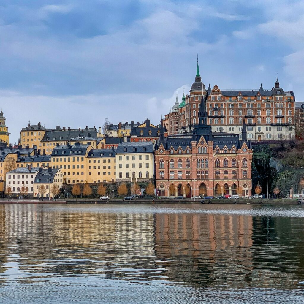
For a generation the Royal Docks has been seen as one of London’s key regeneration sites. Strategically located, the docks have long resisted comprehensive development. To date, it remains an intractable and fragmented territory and only very little of it feels public. Now, the Public Realm Framework, launched in March 2020, seeks to transform the area into a sustainable, healthy and inclusive community.
Last November the Mayor of London, Sadiq Khan, announced that the Greater London Authority (GLA) and the London Assembly will leave their current City Hall home near Tower Bridge and relocate to The Crystal building in the Royal Docks in east London. While the downriver move was triggered by the urgent need to find savings as London’s regional government faces an immediate £0.5 billion tax deficit due to the pandemic, it was also billed as an opportunity to drive forward the regeneration of the ‘Royals’.
Regeneration of the Docks
The Docks sit at a strategic intersection between the city and the Thames Estuary within a cluster of so-called Opportunity Areas, defining a growth corridor with the potential for more than 250,000 new homes and 200,000 new jobs over the next 25 years. The new Elizabeth Line high speed rail will shorten journeys into central London to 15 minutes, and additional large transport schemes are being considered to connect the area including the Silvertown Tunnel and extensions of the Docklands Light Railway and the Overground networks across the river.
Stretching across 91 hectares, the Royal Docks comprises the largest area of impounded water in the world. Its construction in 1855 introduced a new scale of commerce to the rapidly growing capital, drawing people and produce from all over the world and forging London’s position as a global leader in trade. Since the last commercial ship left in 1981 when modern container ship operations necessitated the move to deep water harbours downstream, the water space has resisted comprehensive redevelopment and occupation.
The Docks and the difference between the residential and commercial functions
Yet it is the area’s greatest asset. The heroic dimensions of the Docks have for some time supported large scale occupants such as sugar refinery Tate & Lyle, the London City Airport and congress centre ExCeL. Whilst generating significant economic benefits and global links, these islands of activity add to the severances caused by large scale infrastructures, many of which have created a barrier to long-established local communities accessing this water space. Their sense of isolation was exacerbated by two decades of heavy-handed planning through the London Docklands Development Corporation, set up in the 1980s by the conservative Secretary of State for the Environment, Michael Heseltine, who, circling over the area in an aeroplane, dryly observed that “the place was a tip”.
Opposing local councils and residents created an alternative vision for the area, the People’s Plan for the Royal Docks, lamenting “water, water everywhere but none of it for us”. In City and Port, Han Meyer describes how urban development and industrialisaton in the nineteenth century had asserted “four distinct systems of public space” onto the city: an infrastructure of technical facilities such as the port and railroads; an infrastructure of representative social areas, such as squares and terraces; a system of parks; and a modest system of monumental boulevards with a mainly representative function. Yet to date, the Royal Docks remains an intractable and fragmented territory and only very little of it feels public.
More recent residential developments such as those surrounding the Thames Barrier Park have tended to be of insular character. These developments have brought new people to the area but have struggled to address the overall scale and cohesion of the docks. In some ways this conflict perhaps exemplifies what Steen Eiler Rasmussen in London the Unique City considered a permanent characteristic of the city, setting it apart from its continental counterparts: the irreconcilable difference between the residential and commercial functions.
Medium Rectangle
Halfpage


Image (c) 5th Studio
The Docks: innovation and experimentation for London
In 1987 the Royal Docks became a joint initiative of City Hall and local Newham Council, given momentum by its Enterprise Zone status through which the UK government provides business incentives to stimulate economic growth. At the heart of the zone lie large tracts of land owned by the municipality with the potential to create 650,000 square metres of commercial space, 35,000 new jobs and 4,000 homes. Working collaboratively with a wide range of local stakeholders including community groups, developers and local businesses, a joint team oversees over £300 million investment in place making, local connectivity, economic and cultural activation and international promotion over five years.
Spatial design agency 5th Studio worked with the Royal Docks team to develop a comprehensive Public Realm Framework which was published in March 2020 as one in a suite of three parallel strategies which also includes an Economic Purpose Strategy and a Cultural Strategy. Tom Holbrook, founder and director of 5th Studio and a Design Advocate of the Mayor explains that “the key principle of the Public Realm Framework is entitled ‘Occupy the Docks!’ – a slogan that addresses the stubborn resistance to this huge piece of obsolete infrastructure becoming truly urban. In the generation that has passed since the last ship left the Docks, development has taken the form of ‘pioneer enclaves’ generally clustered around the stations of the Docklands Light Railway, but relating poorly to each other and the sense of a coherent whole. The framework seeks to establish the conditions for the emergence of an exemplary public realm which retrofits the current fragmented condition, gluing it all together.
It also encourages a richer and more diverse ecology in future regeneration, exemplifying the Mayor’s ‘Good Growth’ policies.” The Public Realm Framework sets out a vision to re-imagine the role of the water, helps plan for new public realm improvements, and creates a structure for longer-term asset and water stewardship. The development of the framework involved extensive consultation, both with local residents and community groups, and workshop sessions with the landowners and developers who will be responsible for delivering much of the new public realm. ‘Occupy the Docks!’ positions the area as an urban test be and a site of innovation and experimentation for London, expressed in a joyful and optimistic spirit reminiscent of the Festival of Britain which set in motion the transformation of the South Bank sixty years ago.
Medium Rectangle
Halfpage

Image (c) 5th Studio
Infrastructure for active water use
The public realm aims to support a programme of events and cultural uses as well as appropriate commercial possibilities to activate the water and create new productive places which create social value. It also sets out some key opportunities for this innovative culture to drive forward City Hall’s Healthy Streets agenda and emerging thinking on energy and environmental sustainability. Crucially, the work also seeks to integrate physical proposals with an authentic connection to the area’s history, reinforcing a sense of place and activating a legacy of industry, global trade and cultural exchange.
The next 15 years will see the continued delivery of major mixed-use schemes within the area. These projects will deliver public spaces and connectivity improvements, but there are substantial gaps where the public sector can invest alongside commercial developers. The Public Realm Framework has identified a number of ‘Intervention Sites’ where investment should be focused to address deficiency in access to open space and to create a diversity of spaces, from local parks and squares to places for metropolitan-scale events. Four guiding principles focusing on ‘Water’, ‘Places’, ‘Stitches’ and ‘Landscape’, aim to orientate thinking around a commonly-held set of intentions, to ensure that the emerging whole is greater than the sum of the various parts.
The guiding principle ‘Water’ recognises that the water spaces of the Royal Docks are the area’s biggest asset, but that the potential for accessing and enjoying these spaces is very different across the Docks, with distinct identities and regulatory requirements which are mainly driven by security concerns for the airport and safety. A key proposal is to develop a publicly accessible dock edge which is coherent and legible across the various land ownerships. Access to the dock edge should be supported by an infrastructure for active water uses such as piers, pontoons, and lidos, and a network of routes with utility and recreational value – connecting communities and green spaces and promoting healthy lifestyles.
Medium Rectangle
Halfpage

Image (c) 5th Studio
Supporting the improvement of existing public realm
The guiding principle ‘Places’ amplifies the distinctiveness of existing and emerging clusters of activity with the aim to crystallize identifiable neighbourhoods which can have a particular economic or cultural offer operating at local, city wide and global scales. One such key place is Royal Victoria Dock West, one of the main points of arrival to the Docks with few restrictions on activity in the dock water, which has the potential to host a new major cultural institution to place it within the wider sub-regional scale of east London, with the Museum of London Docklands, maritime Greenwich, and other larger scale attractions such as the O2 Arena and ExCeL nearby. The framework proposes a series of well-connected public spaces to accommodate large numbers of people and to allow for the cultural programming in this location.
A very different objective underpins the plans for Albert Island at the very eastern edge of the Docks: it is a place with a focus on industry and making. A new shipyard is proposed which will service and repair Thames riverboats, while the local marina is to be upgraded. These maritime uses sit alongside other businesses and institutions, such as the University of East London, which aim to promote enterprise and skills. Here the unique qualities of the site should be exploited to provide alternative pedestrian and cycle routes to Gallions Reach and the Thames Path.
A suite of smaller scale ‘bottom-up’ projects is proposed to support community-led growth in North Woolwich, an area that has historically suffered from isolation as well as a lack of investment in public realm and social facilities. Projects here should look to overcome this inequality through supporting the improvement of existing public realm and community spaces with a co-production approach.
Medium Rectangle
Halfpage

Image (c) 5th Studio
Resilient city
The ‘Stitches’ principle sets out how to improve connections across the Docks and bring people to the water. The irony of much of the transport infrastructure within the Royal Docks, while it effectively solves issues of connectivity at a London-wide or even global scale, is that it creates severances at a local level. Communities immediately to the north of the Royal Docks have very few, poor quality access points into the area. Through improving the infrequent connections across the length of the docks to fully weave them into the rest of Newham, transforming peripheral industrial roads into integrated urban streets and improving the cyclist and pedestrian experience at key crossing points such as the central Connaught Crossing, the public realm should support residents and visitors in accessing and moving across the area more easily and safely.
Finally, the ‘Landscape’ guiding principle seeks to ensure that there is coherence across the areas that together make up the Royal Docks. Based on the understanding that landscape operates on a coarser grain than urban development, four character areas describe the broad character of the landscapes that underlie the Royal Docks territory to inform design approaches which root the public realm in place: Urbanised Hollow, Suburban Marshes, Engine Room and Maritime Thames. These landscapes are predominantly man-made, with few remaining traces of the original Thames floodplains and marshes, though pioneer species have begun to rewild many of the brownfield sites which have so far been left undeveloped.
As the Docks will be developed incrementally over time through a variety of developers and agencies the robustness of the framework will be put to the test. 5th Studio has continued to strengthen the strategies in the framework through the production of a series of tactical Design Guides which will steer the delivery of the finer grain of individual projects by providing integrated and consistent approaches to lighting, wayfinding, landscape and material palette. The step change in the Royal Docks coincides with a moment where the roles, definitions and methods of production of public realm and infrastructure are rethought. Tom Holbrook reflects that “the disruption of the pandemic is a dress rehearsal for the coming upheavals of the climate emergency, reminding us how important it is to create a resilient city.
Medium Rectangle
Halfpage

Image (c) 5th Studio
Fresh perspective on the potential
The Royal Docks is rich in infrastructure: its piers, locks, docks and bridges, stations and viaducts will need to be augmented with new infrastructures as the docks change and London responds to the changing climate. Rather than replicating the top-down instrumental nature of the original docks, this new infrastructure must play a more complex, integrated role, creating opportunities for public interaction, urban greening and co-production.”
Julian Lewis, one of the Mayor’s Design Advocates, corroborates that “until recently it was difficult to think of anything but building new housing as the means by which the challenges faced by London’s growing population could be met. The arrival of COVID-19 on the scene, however, has resulted in a shift of focus. The capacity of the public realm to support Londoners’ mental and physical health is now rivalling the housing programme as an urban condition needing urgent review.” The GLA has therefore recently published the Expanding London’s Public Realm design guidance which gives a fresh perspective on the potential to enrich London’s shared spaces, illustrating a detailed compendium of space types beyond the traditional streets, squares and parks that can support the city and shows how they can be used together.
Medium Rectangle
Halfpage
Billboard
Other Articles you may like